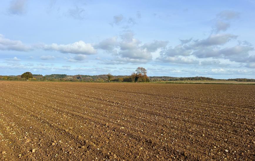
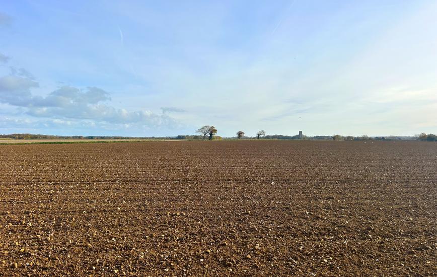
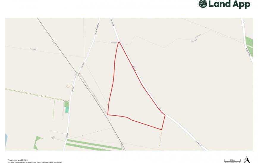
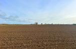
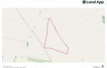
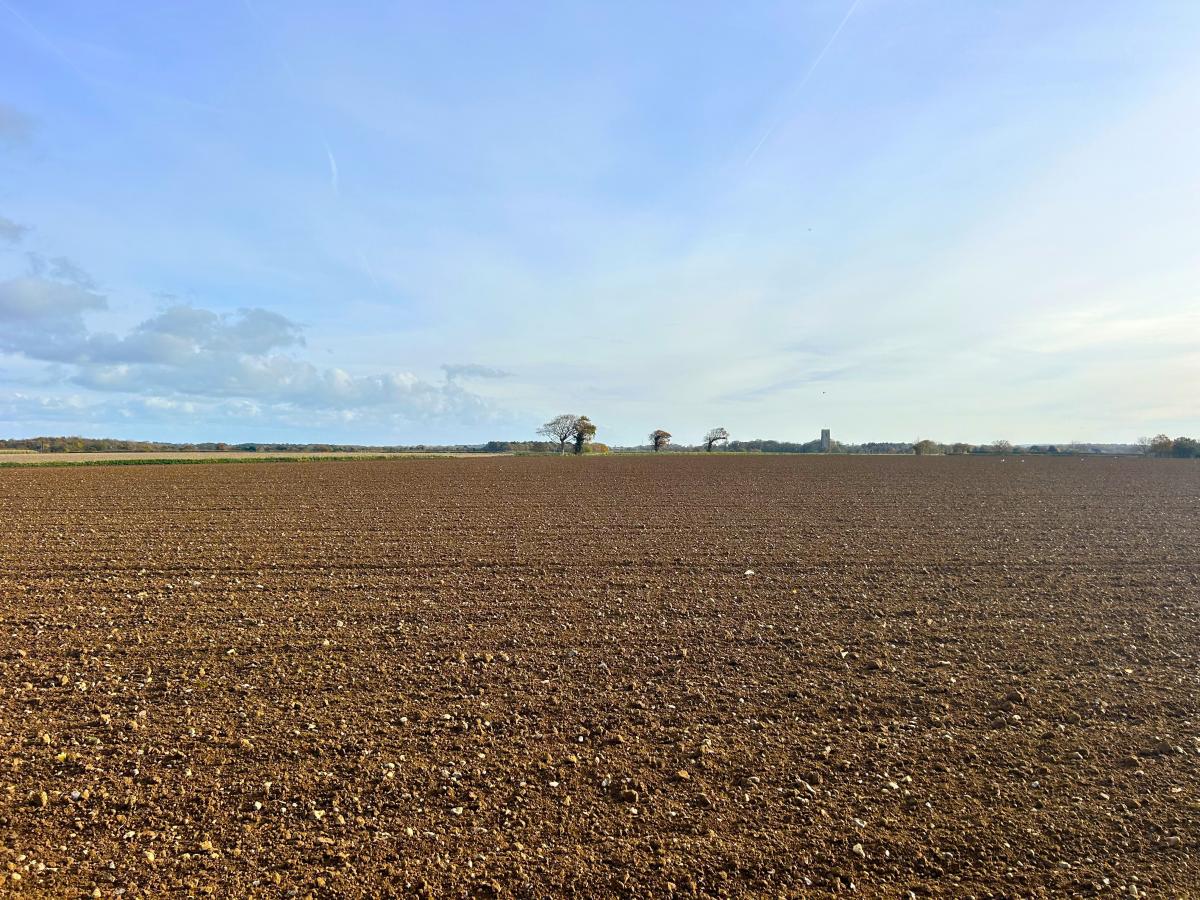
One parcel of Grade 2 arable land extending in all to approximately 9.56 Hectares (23.62 Acres).
The parcel lies in the parish of Southrepps and can be accessed directly off Sandy Lane along the northeastern boundary.
The land is gently undulating and has recently been cropped with sugar beet and potatoes. The soils are of the Hall and Sheringham soil series described as being free draining, slightly acid loamy soils suitable for a range of spring and autumn sown cereal and vegetable crops.
The boundaries are well established and visible, consisting of a combination of mature hedging, trees, banks and road.
The land is suitable for continued agricultural use, alongside environmental schemes. Alternatively, it could be used for amenity purposes or for biodiversity net gain (BNG) purposes.
LOCATION
The land is located off Sandy Lane, 0.5 mile northwest of the village of Southrepps , 4 miles southeast of the coastal town of Cromer, and 6 miles northwest of the market town of North Walsham.
DIRECTIONS
From North Walsham, head northwest along the Cromer Road (A149) for approximately 5 miles before turning right onto Thorpe Road. Continue along Thorpe Road for 1 mile until you reach the village of Southrepps and take a sharp left onto Sandy Lane. Follow the road for approximately 0.5 mile and the field entrance will be on your left.
NOTE: Please take care when exiting the field entrance onto the highway.
VIEWING
Viewing during daylight hours only with a set of particulars in hand. Please be vigilant and take care when making your inspection, in consideration of your own personal safety.
METHOD OF SALE
The property is offered for sale by Private Treaty as a whole at a guide price of £280,000.
TENURE AND POSSESSION
Freehold.
MINERALS, TIMBER AND SPORTING RIGHTS
In so far that they are owned by the vendor, the minerals, timber and sporting rights are included in the sale.
LAND REGISTRY
The land is registered under Land Registry Title Number NK527272.
RURAL PAYMENTS AGENCY
The land is registered with the Rural Payments Agency.
ENVIRONMENTAL STEWARDSHIP
The land is not entered into an environmental stewardship agreement.
PLANNING
The property is within the jurisdiction of North Norfolk District Council, to whom interested parties are advised to make their own enquiries in respect of any planning issues and development opportunities for the
RIGHTS OF WAY, EASEMENTS, WAYLEAVES AND COVENANTS
The property is sold subject to, and with the benefit of all easements, rights of way, privileges etc., which may affect the same, whether mentioned hereto or not.
OUTGOINGS
Environment Agency General Drainage Charges.
INGOING VALUATION
The sale will be subject to an ongoing valuation comprising of the cost of inputs and work done.
AUTHORITIES
Broadland District Council - 01603 431133
Norfolk County Council - 0344 800 8020
Environment Agency - 0870 850 0250
Rural Payments Agency - 03000 200 301
VAT
No Value Added Tax shall be payable on the transaction.
PARTICULARS AND PLANS
These particulars and plans are based upon the Ordnance Survey metric editions and are believed to be correct, but their accuracy cannot be guaranteed.
DISPUTES
Should any dispute arise between the Vendor and the purchaser(s) as to the boundaries, fences or any other point arising out of these particulars, then the Agent's decision shall be binding upon all parties.